

PROPRIETARY ENGINEERING TECHNOLOGY
POCO - Integrated offshore engineering environment.
POCO brings spatial project information, hydrodynamic simulation, metocean analysis and engineering calculations together to support efficient, traceable offshore design decisions.
THE ENGINEERING ENVIRONMENT
Project context and physics in one workflow.
The POCO desktop environment connects offshore project geography, engineering assets, environmental datasets and numerical modelling within one software workspace. Its modules allow users to move between GIS-based project design, hydrodynamic simulation, metocean analysis and engineering calculations.
The result is a clearer progression from project data to engineering-ready design conditions, technical assessments and documented outputs that can support decisions across offshore developments.
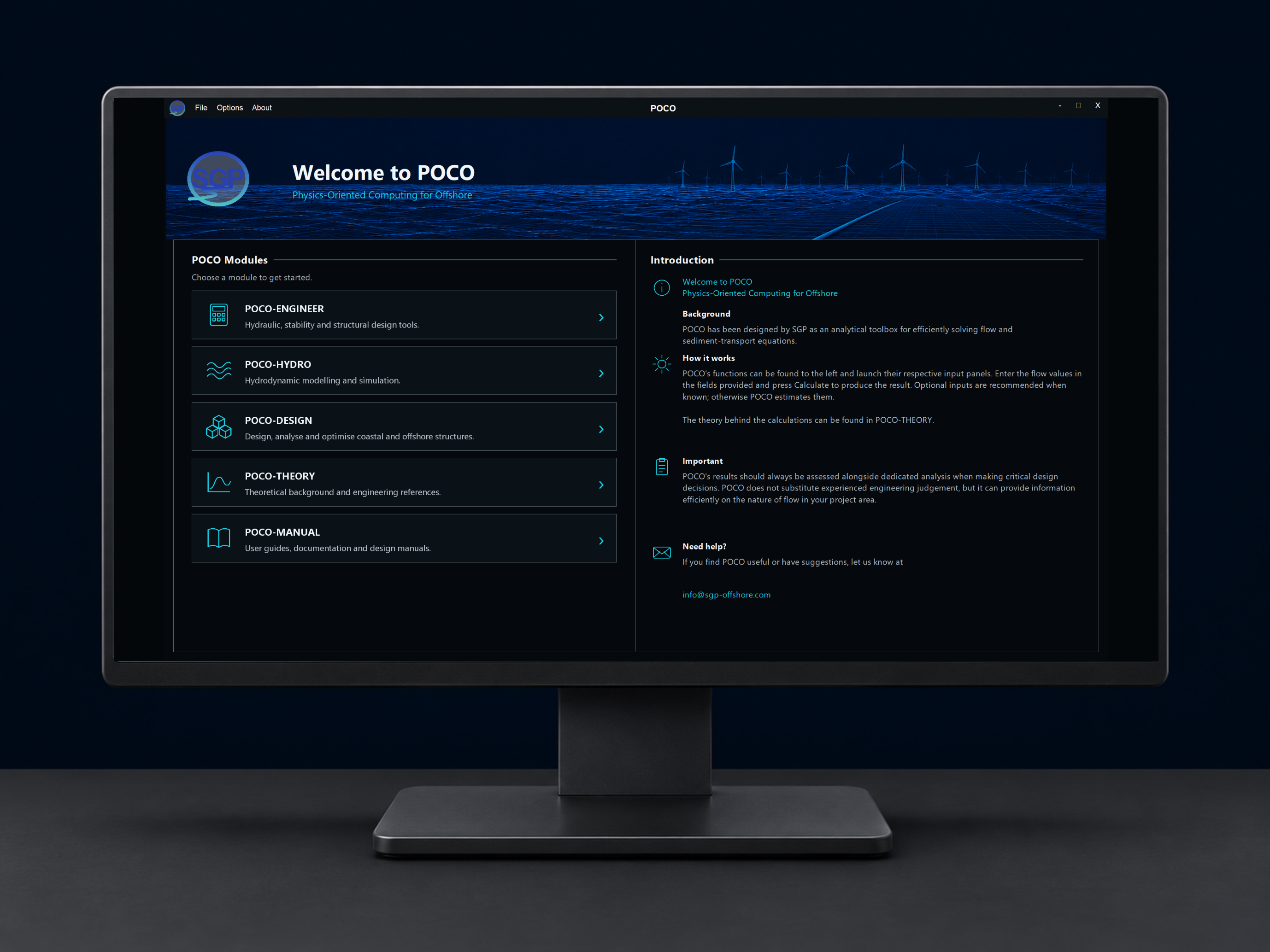
POCO ENGINEERING MODULES
One environment. Multiple engineering functions.
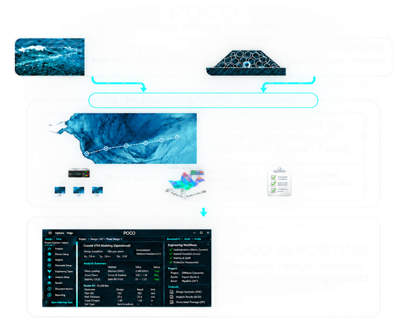
FROM DATA TO ENGINEERING EVIDENCE
A connected, traceable engineering workflow.
01
Spatial project data
Define the project environment, infrastructure and relevant datasets.
02
Environmental modelling
Characterise hydrodynamic and metocean conditions as appropriate.
03
Engineering assessment
Apply those conditions to stability and design calculations.
04
Reviewable results
Retain a clear relationship between input information and analysis outputs.
POCO HYDRO · REGIONAL MODEL OUTPUT
Tidal water levels across the UK continental shelf.
POCO Hydro shows how sea-surface elevation changes through the tidal cycle across the regional model domain.
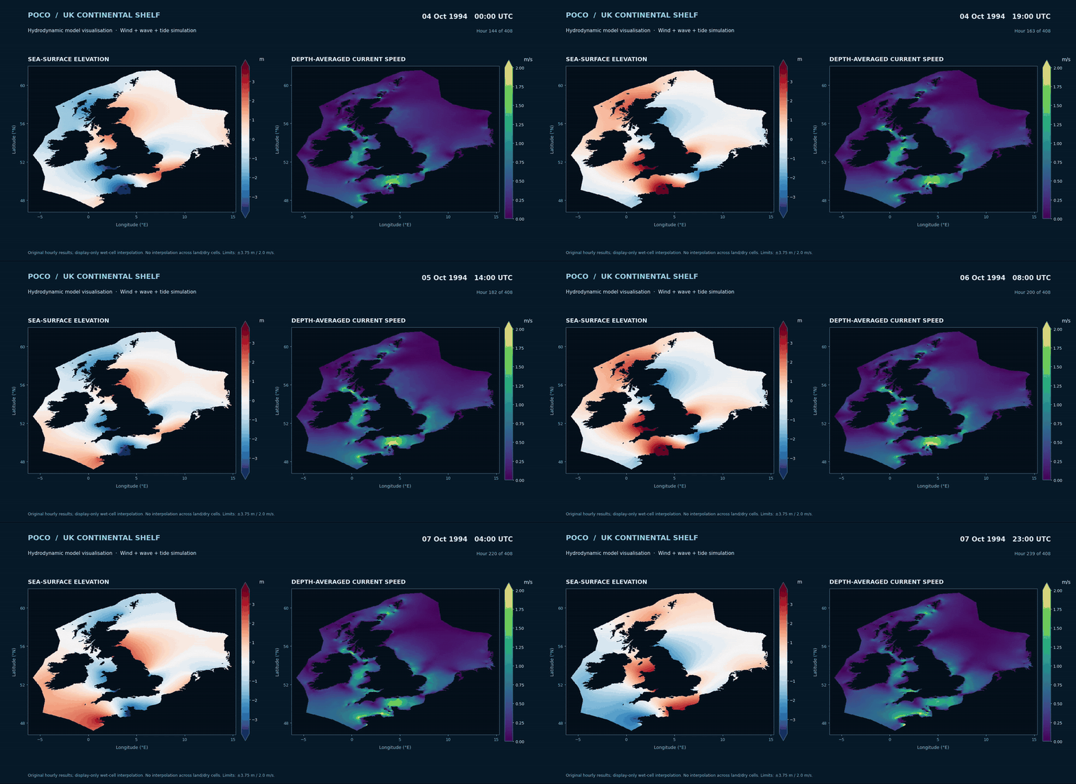
UK shelf model, October 1994. This eight-second excerpt shows sea-surface elevation in metres on a fixed colour scale.
POCO - accessible, traceable, reliable
From mapped project data to engineering evidence.
Explore the working POCO interface across spatial design, environmental time-series analysis, numerical hydrodynamics and automated reporting.
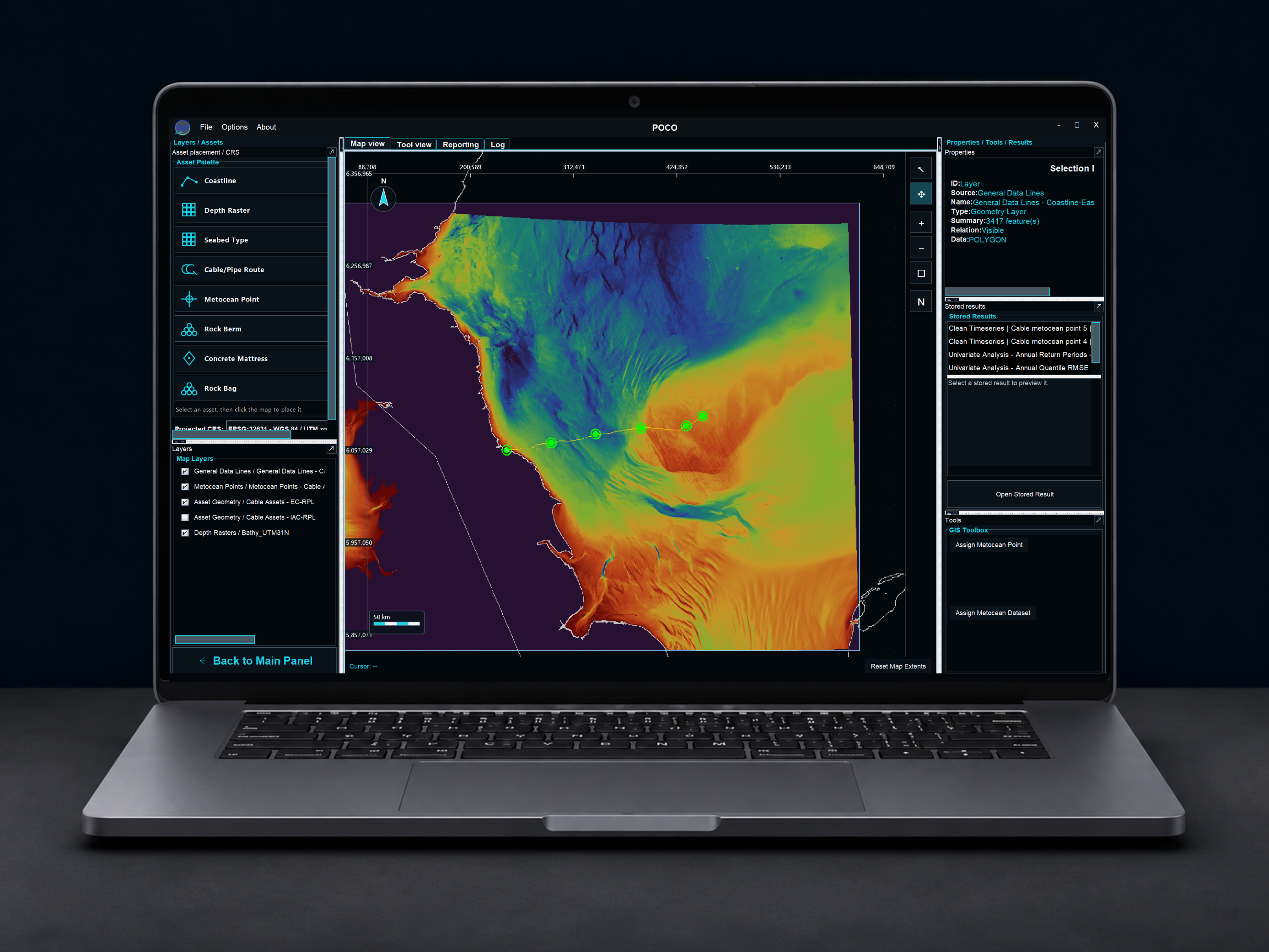
POCO Design — spatial project workspace
Bathymetry, coastlines, cable routes and metocean design points are managed together in an interactive GIS environment.
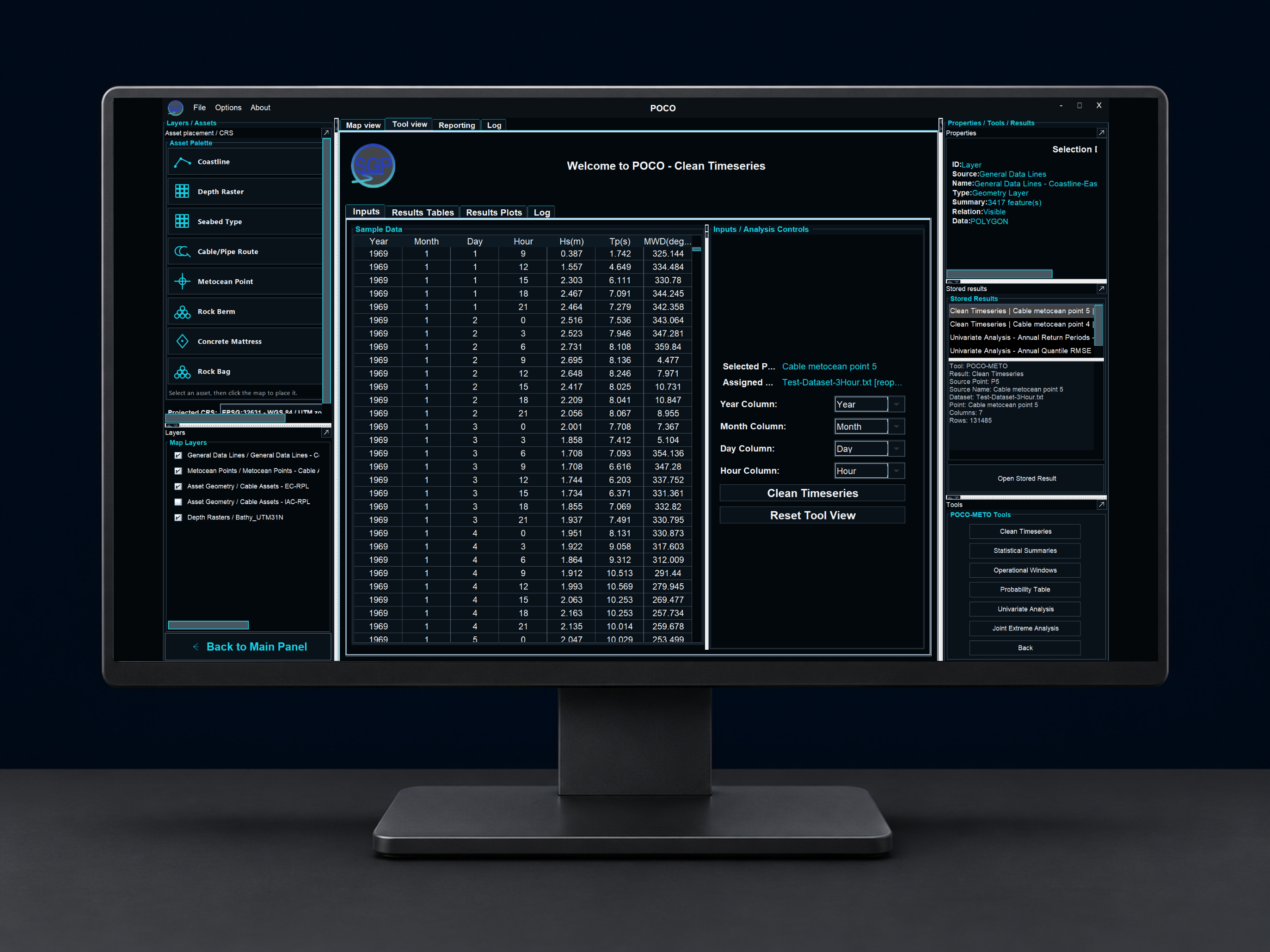
POCO Design — environmental data
Connect time-series datasets to spatial design locations, clean inputs and retain analysis results within the project.
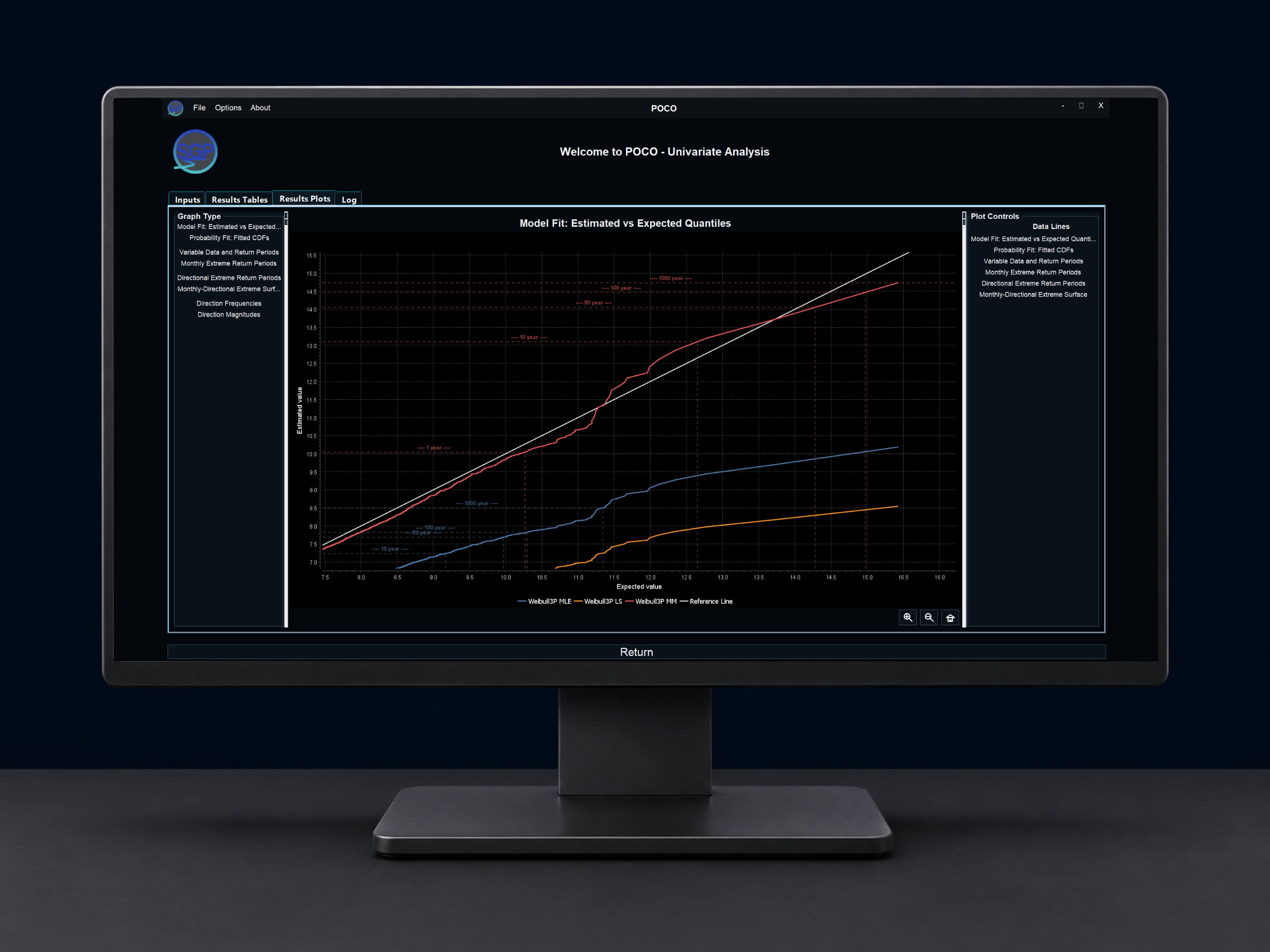
POCO Metocean — extreme-value analysis
Compare fitted statistical models and return-period quantiles for offshore design conditions.
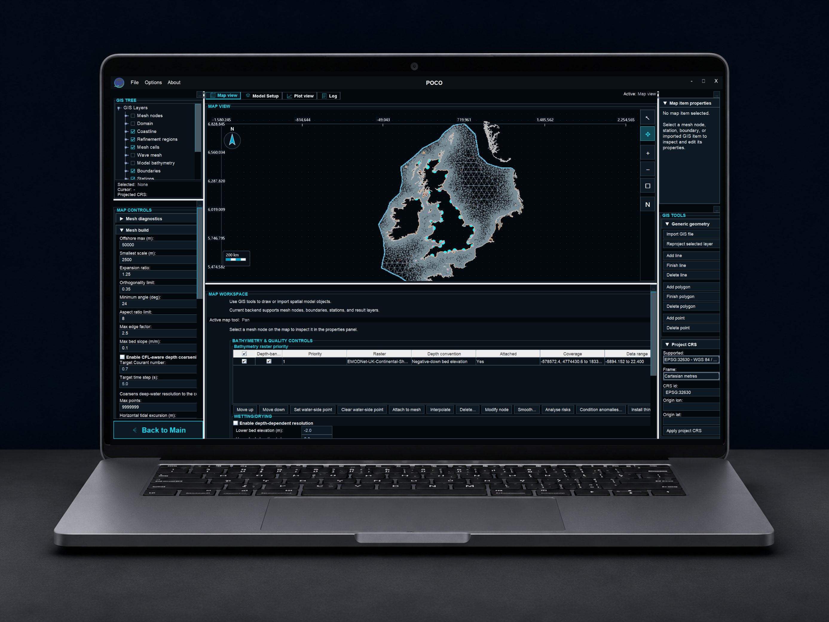
POCO Hydro — computational mesh
Construct and inspect a regional unstructured mesh with coastal detail, boundary controls and observation locations.
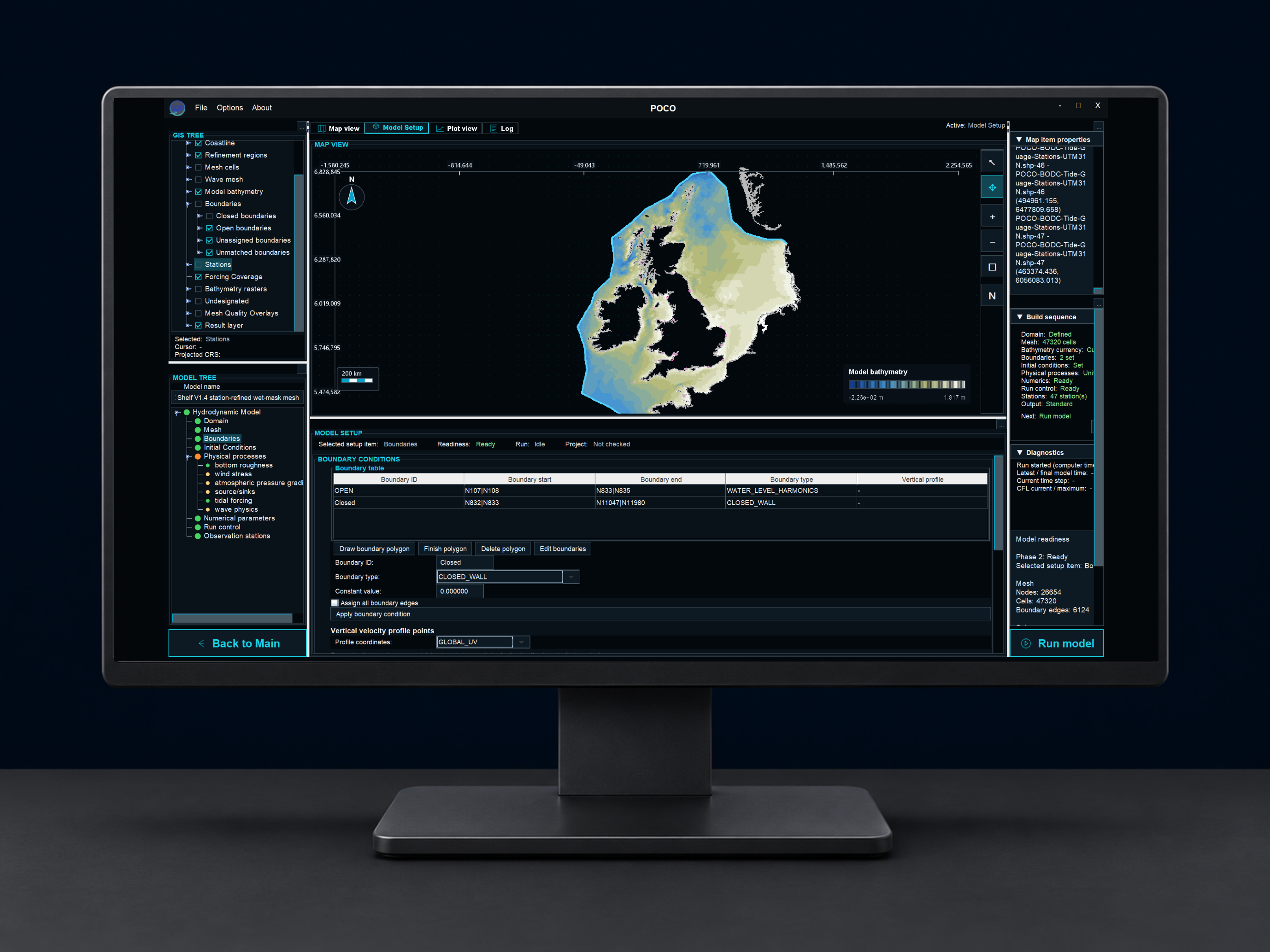
POCO Hydro — numerical model setup
Review model bathymetry, boundary forcing, setup readiness and solver configuration in the Hydro workspace.
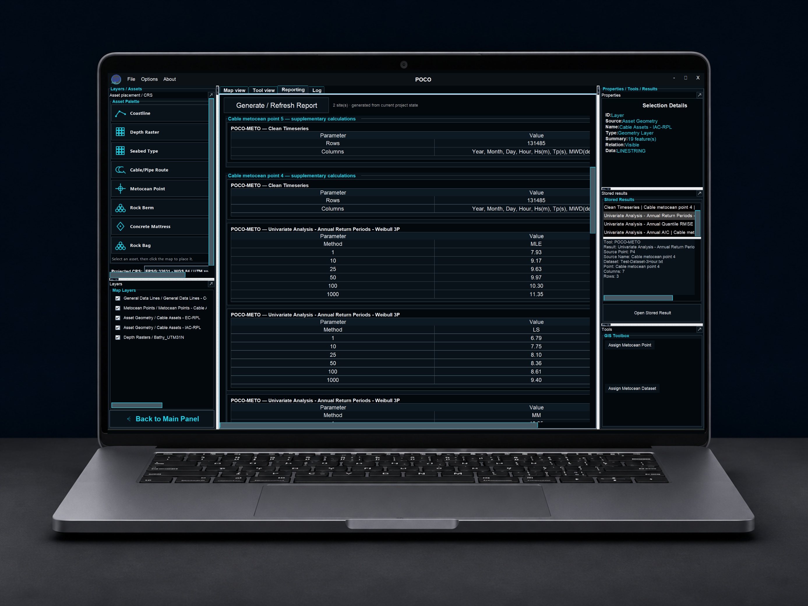
POCO — automated reporting
Generate structured project reporting that brings together site-specific model inputs, metocean analysis and engineering results.
POCO-ENABLED ENGINEERING
Interested in an integrated engineering approach?
Talk to SGP about a specific offshore design challenge and where existing POCO capabilities may support the assessment.
